GNSS Technologies

GNSS is the standard generic term for satellite navigation systems that provide autonomous geo-spatial positioning with global coverage. Any GNSS is used to pinpoint the geographic location of a user’s receiver anywhere in the world.

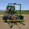
GPS-based weed control in vegetable field [Farmer]

  Scientific Article Development and field evaluation of a completely automatic system for intra-row weed control in tomato fields. This system uses an automatically generated GPS crop plant map to automatically control the path of a set of mechanical intra-row weed knives in order to kill weeds growing between tomato plants in the seedline. The… read more »

GPS-based weed control in vegetable field [Student]

  Scientific Article Researchers at UC Davis and elsewhere have demonstrated the technical feasibility of using RTK-GPS technology to automatically create crop plant maps at planting (Sun et al., 2010; Perez-Ruiz, 2011). This paper describes the development and field evaluation of a completely automatic system for intra-row weed control in tomato fields. This system uses… read more »

GPS-based weed control in vegetable field [Professional]

  Scientific Article Researchers at UC Davis and elsewhere have demonstrated the technical feasibility of using RTK-GPS technology to automatically create crop plant maps at planting (Sun et al., 2010; Perez-Ruiz, 2011). This paper describes the development and field evaluation of a completely automatic system for intra-row weed control in tomato fields. This system uses… read more »

Real Time Kinetic mobile machine control [Farmer]

Introduction Effective Real Time Kinematic (RTK) mobile machine control requires a sufficient number of global positioning system (GPS) satellites that are both visible and suitably positioned. Reliably obtaining the highest degree of accuracy and precision afforded by RTK technology requires satellites from multi-national Global Navigation Satellite System (GNSS).[1]     Find out more by watching… read more »

Real Time Kinetic mobile machine control [Student]

Introduction Real Time Kinematic (RTK) mobile machine control requires a sufficient number of global positioning system (GPS) satellites that are both visible and suitably positioned. Reliably obtaining the highest degree of accuracy afforded by RTK technology requires the initial acquiring of a solution, the maintaining and if it is lost, rapidly reestablishing the RTK fix… read more »

Real Time Kinetic mobile machine control [Professional]

Introduction Real Time Kinematic (RTK) mobile machine control requires a sufficient number of global positioning system (GPS) satellites that are both visible and suitably positioned. Reliably obtaining the highest degree of accuracy afforded by RTK technology requires the initial acquiring of a solution, the maintaining and if it is lost, rapidly reestablishing the RTK fix… read more »

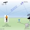
GNSS (Global Navigation Satellite Systems) [Professional]

Introduction Global Navigation Satellite System (GNSS) is a satellite navigation system with global coverage that uses satellites to provide autonomous geo-spatial positioning.[1] The satellites provide signals from space that transmit positioning and timing data to GNSS receivers. The receivers then use this data to determine location[2] and also provide navigation or tracking the position of… read more »

Yield Mapping and Yield Sensors [Professional]

Introduction Yield monitor is a device combined with other sensors that calculates and records the crop or grain yield while harvesting machines operate. Yield monitors one of the most widely used commercial products and have been available on the market for more than two decades. A yield monitor is most useful with a Positioning System (GPS)… read more »

Yield Mapping and Yield Sensors [Student]

Introduction Yield monitor is a device combined with other sensors that calculates and records the crop or grain yield while harvesting machines operate. Yield monitors one of the most widely used commercial products and have been available on the market for more than two decades. A yield monitor is most useful with a Positioning System (GPS)… read more »

GNSS (Global Navigation Satellite Systems) [Farmer]

Introduction Global Navigation Satellite System (GNSS) is a satellite navigation system with global coverage that uses satellites to provide autonomous geo-spatial positioning.[1] The satellites provide signals from space that transmit positioning and timing data to GNSS receivers. The receivers then use this data to determine location[2] and also provide navigation or tracking the position of… read more »

Sidebar