
Irrigation: Advancements and State of the Art [Student]
Introduction
Population increase and the improvement of living standards brought about by development will result in a sharp increase in food demand during the next decades. At the same time, water inputs will have to be reduced in response to water scarcity and environmental concerns. Water productivity is projected to increase through gains in crop yield and reductions in irrigation water. In order to meet these projections, irrigation systems will have to be modernized and optimized.[1] Best management practices need to be adopted, while precision agriculture can provide the right tools and techniques for optimized water use. Meteorological conditions’ monitoring, soil moisture sensing and automated systems for irrigation can bring the desirable results.
Related Smart Farming Technology Products
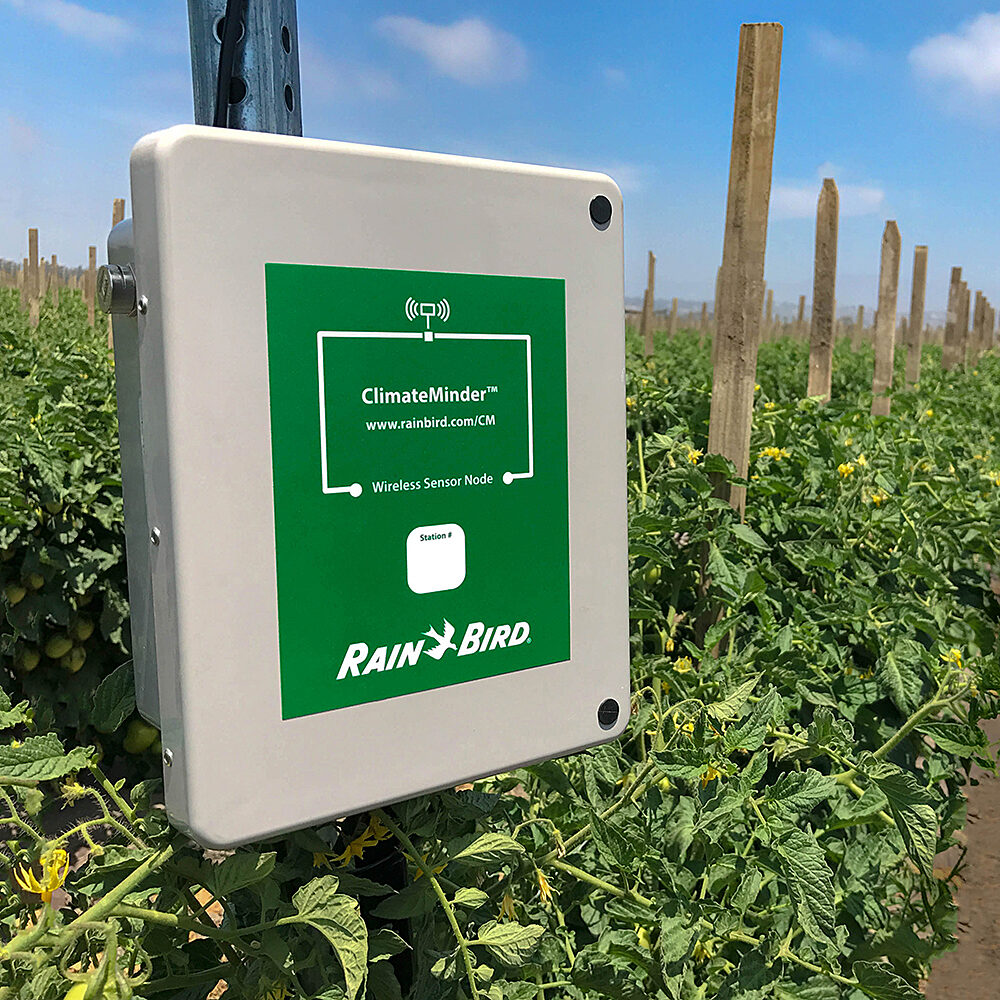
1. ClimateMinder Soil Monitoring[2]
Easy to Use and Well Supported
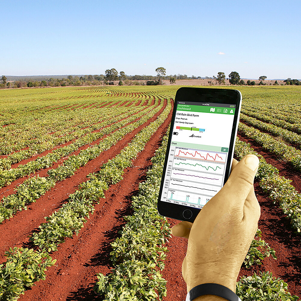
Simple to use clean interface answers the question growers need to know:
- Did the system run last night? Was it off or a had a problem?
- Irrigate enough? Too much?
- Is fertilizer leaching? Did it penetrate all the way?
System to Grow With
Start with one unit and add more as fields grow and expand. All the data is collected and presented in the same easy-to-read interface.
The following images shows ClimateMinder Soil Monitoring with App:


2. SmartRain App
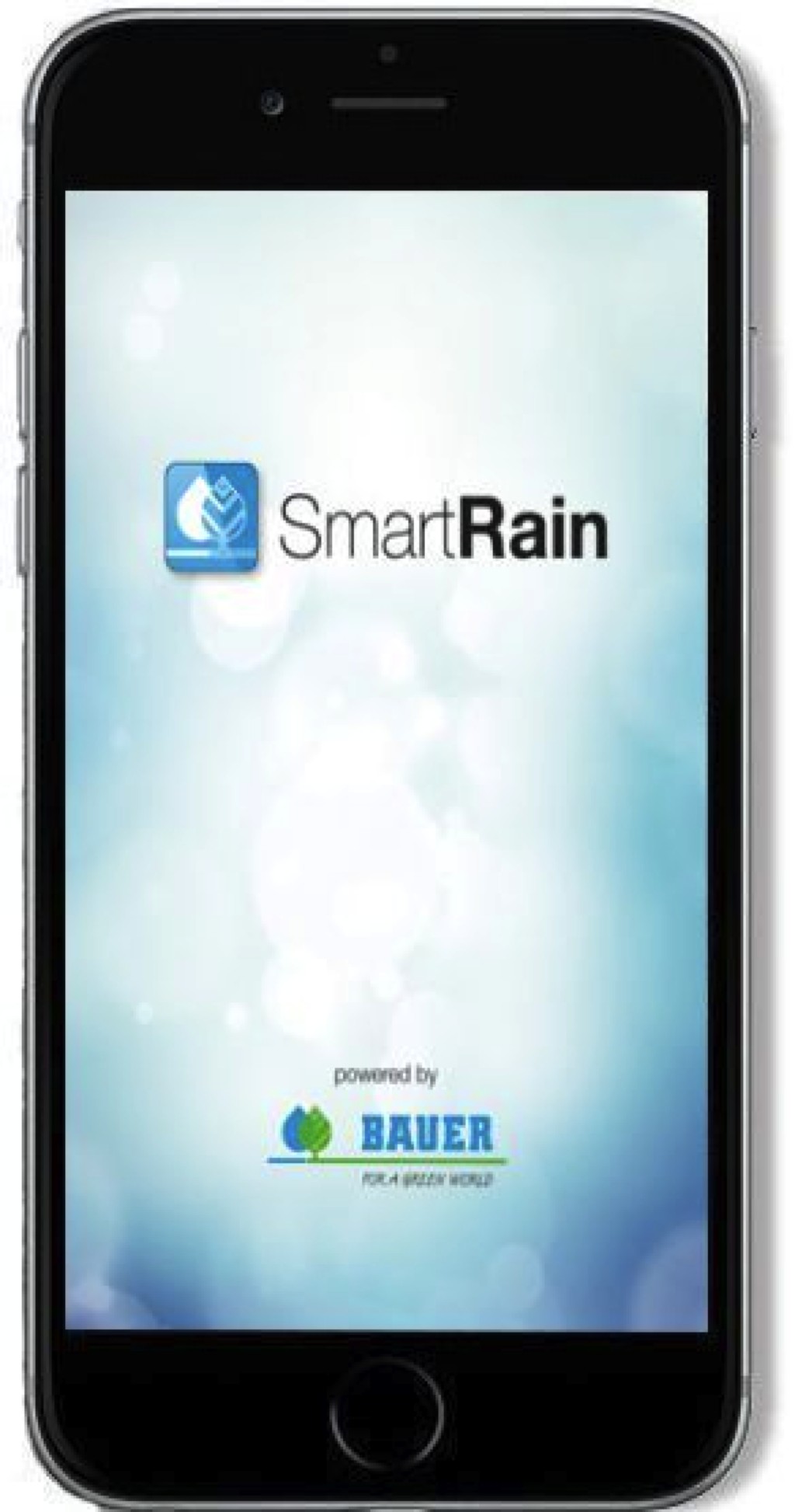
The SmartRain App gives the possibility to control machines from any location. Get an overview with actual status information such as remaining irrigation time, remaining PE-pipe to pull back in, time to change the irrigation strip and more.
Which area needs to be irrigated next? Which irrigator will be finished next? Optimize the application rate depending on the soil moisture and weather conditions.

User will get an Error message via SMS on phone if the irrigator has stopped because of any malfunction or if it comes into a danger area.
Pivot, Rainstar and pumps can be operated directly through Smartphone or Tablet.
Manage teams, operators or contractors who are working with machines.Create reports for water usage, soil conditions for internal use or business purposes fully automatically.

■ Solar powered GPS controller directly on the sprinkler cart or Pivot control unit PRO-G directly on the central tower
■ Access to “SmartRain” internet platform with personal login
■ Smartphone-App for fast and easy access from any location.

Based on measurements and information about soil conditions, soil moisture, size and shape of different fields, actual usage of different machines and much more, user can continually optimize irrigation management and to reduce costs.
Documentation Reports for water use of different wells or ditches for authorities. All data will be saved automatically and can be printed out at any time.[6]
 |  |  |
|---|---|---|
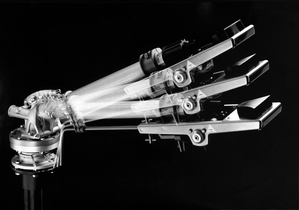
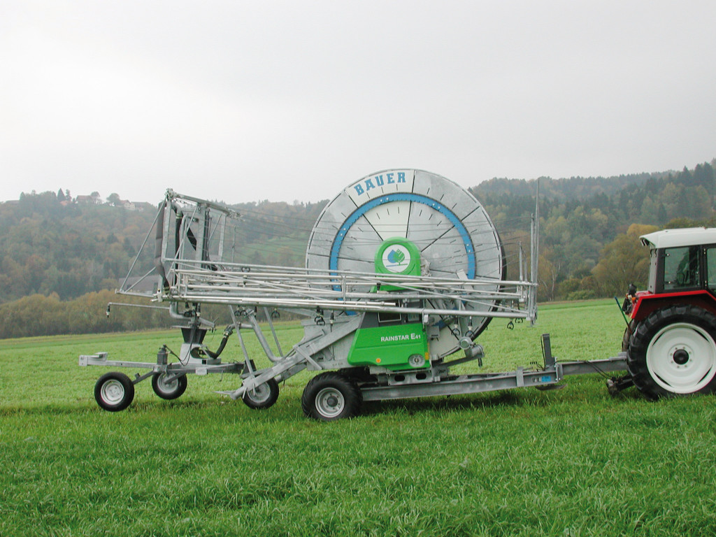
Figure 1:VARI-ANGLE effective irrigation. | Figure 2 Compact transport unit | Figure 3: Smart Rain. |
3. TERRAPRO
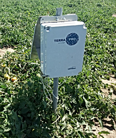
TERRAPRO provides specialized technical advisory services for the efficient use of water and sustainability of agricultural enterprises:
- Reduction of irrigation costs
- Reduction of fertilization costs by improving understanding of the relationship between soils, plants (their productive potential) and the most effective fertilization
- Greater efficiency of all factors of production
- Monitoring, analysis and quantifications based on aerial imaging
- Increased productivity and product quality

With a proven increase of 30% in irrigation efficiency, irrigation management services allow the farmer to decide in a more sustainable way on when to water, how much water to apply and quantify the efficiency of irrigation in crops.
- No need to purchase probes
- No worries with technical and equipment maintenance
- Online access and in real time to the data of the probes
- Specialized technical monitoring in continuous – uSENS software
- Irrigation recommendations according to the objectives of agricultural production
THE SERVICE INCLUDES:
- Initial visit of a technician to the field
- Installation, maintenance and uninstallation of equipment
- Monitoring of soil moisture content
- Monitoring of irrigation applied
- Meteorological monitoring
- Data available permanently and real time in the software online – uSENS
- Data transmission service (GSM cards)
- Customized technical follow-up by a TERRAPRO technician
- Monthly visits to the field, throughout the campaign
- Issuance of weekly reports: including weather forecasts
- Field observations, sensor registration and irrigation recommendations for the following 8 days
- Final report of the agricultural campaign
APPLICATION:
- Support for decision-making in the organization of plots, planting of crops and implementation of the irrigation and fertilization system
- Identification of critical areas to perform sampling or definition of soil moisture monitoring sites
- Produce comparative maps of support for management, for example, in the comparison of expected / obtained productivity or between campaigns.
- Relevant information for differential irrigation calculations (VRI pivot, irrigation sectors)
SERVICE INCLUDES:
- Field data collection
- Processing of information georeferencing
- Technical report with the elaboration of the CEa Classified Map of the soil
- Meeting with client for critical discussion of results and support for decision
MAPPING OF THE APPARENT ELECTRICAL CONDUCTIVITY OF THE SOIL
The Apparent Electrical Conductivity of the soil (CEa) represents the capacity of the soil to conduct the electric current and allows to evaluate, in addition to the physical properties of the soil, the availability in water and nutrients.

APPLICATIONS
- Monitoring of growth and vegetative vigor of the plant Optimization of irrigation and fertilization
- Optimization of the application of pesticides and herbicides
- Selective harvest
- Estimates relative to production
THE SERVICE INCLUDES:
- Digital Aerial Photography
- Georeferencing and orthorectification of multispectral images
- Treatment of the NDVI and classification map
- Critical analysis in compliance with other monitoring systems TERRAPRO (when applicable)
- Technical report with NDVI classification
- Technical meeting with the client for critical discussion around the results and support for decision making[8]
Find out more about TERRAPRO technologies:
4. Vaisala hydrometeorological stations
Due to the growth of population throughout the world, there is pressure to improve methods and practices of agriculture in order to increase crop yields. The main concern of productive agriculture is related to the effective and efficient supply of water that is easily available for crop fields. The major uncertainty with the water supply is associated with unevenly distributed precipitation and with the impacts of climate change on water availability.
Faulty irrigation scheduling will lead to waste of water. Therefore it is crucial to know how much water there is and how much water will be available for irrigation.
Vaisala hydro meteorological stations are used to monitor the amount of precipitation and to measure water levels in reservoirs to provide real-time information on availability of water for irrigation. In addition, Vaisala systems calculate directly evapotranspiration thus providing an indication about the amount of water needed for the plants.

Automatic Weather Station AWS310
A complete communication and data monitoring solution, including sensor, electronics, mast, and power supply – everything you need to start collecting accurate and reliable weather measurements
Features:
- WMO-compliant sensors for validated data
- Easy remote monitoring of network status via optional NM10 software
- Remote configuration management
- Long calibration intervals
- Fast delivery for preconfigured systems

Key Benefits:
- Reliable and trusted
- Proven performance not only through extensive testing in development, but across over 20,000 field installations worldwide
- Lower operational costs
- Long calibration periods and remote configuration management mean greater efficiency – saving you time, money, and field visits
- Multiple configurations
- Commonly requested options are preconfigured, but the AWS310 is fully customizable to your specific application
HydroMet™ Automatic Weather Station MAWS201
The Vaisala HydroMet™ Automatic Weather Station MAWS201 is a portable AWS for temporary installations, featuring the same design as the Vaisala TacMet Tactical Meteorological Observation System MAWS201M for demanding tactical meteorological applications. Its lightweight aluminium tripod and easy-to-use connectors make it fast to set up. Each leg is adjustable for use on uneven terrain.

Key Benefits:
Field-proven in a wide range of applications
Including but not limited to:
• Meteorological research
• Civil defense
• Environmental impact studies
• Emergency response
• Fire weather
• Waste management
Lightweight, easy-to-transport setup:
With 5 basic sensors, a solar panel and a battery the MAWS201 weighs just 15 kg. It can be transported in two lightweight carry cases made of cellular polypropylene (EPP), a lightweight but very rugged material that provides excellent protection. The cases are equipped with handles, hinges, wheels and latches for padlocks.
Extensive sensor options and outputs:
The basic suite of sensors typically measures wind, pressure, temperature, relative humidity, and precipitation. In addition, measurements can be taken of e.g. multi-level soil temperature, soil moisture, global and net solar radiation, water level, and temperature. Generic and configurable 16 bit A/D conversion is included in case you want to interface your own sensors. In addition to the standard meteorological and statistical calculations, the extended calculation library also includes evapotranspiration, heat index, forest fire index, wind chill and many others.[9]
5. Toro TFS series flow sensors
The Toro TFS series flow sensors provide reliable flow information to aid in the detection of and response to system issues like piping breaks, while being accurate enough for tracking water usage.[10]

Features:
- Effective Flow Monitoring Even In Flows Less Than 5 GPM Effective in ranges from 1.2 GPM to 500 GPM. Teamed with the Toro TMC-424, ½”, ¾” and 1” sensors provide a cost-effective flow monitoring and alarm system.
- Compatible With Competitive Controllers In addition to the TORO compatible controllers – TMC- 424E, TIS-PRO, Sentinel® and SitePro® – these flow sensors work with any controller or control system compatible with frequency output flow sensors.
Compatible with Competitor Controllers PVC tee fl ow sensors from ½” to 4” provide options for fl ow measurement from 1.2 to 500 GPM, making these sensors ideal for residential, commercial, municipal, and sports field applications.
RELIABILITY Durable, impeller-based sensor provides accurate fl ow information. Potted design withstands the elements and provides options for valve box mounting or direct burial. PEACE-OF-MIND Coupled with the TMC-424 or one of Toro’s other fl ow sensing control products, the TFS series provides a solution for the detection and isolation of system leaks or piping breaks, preventing washout or other damage.
Related Scientific Articles
1. Meteorological automated weather station data application for plant water requirements estimation[11]
In order to adequately control water requirements for plants, it is necessary to perform continuous standardized meteorological conditions measurements from the largest possible number of points. The aim of this research was a comparison of the selected agrometeorological indices essential in agriculture (precipitation, reference evapotranspiration, climatic water balance and standardized precipitation index), measured or calculated in the growing season (from April to September) at standard and automatic weather stations and a verification whether the automated station data can be applied without any modifications whatsoever. The focus of the research was the interaction between the data series compared. Searching for the ways to adjust the automated to standard 10-day growing season data was an important aspect of the investigation. Despite the different measurement results between both stations compared, great correlation coefficients of the results facilitated the development of mathematical formulas to allow for the use of the automated data series instead of standard records.
2. Large-scale on-farm implementation of soil moisture-based irrigation management strategies for increasing maize water productivity[12]
Irrigated maize is produced on about 3.5 Mha in the U.S. Great Plains and western Corn Belt. Most irrigation water comes from groundwater. Persistent drought and increased competition for water resources threaten long-term viability of groundwater resources, which motivated research to develop strategies to increase water productivity without noticeable reduction in maize yield. Results from previous research at the University of Nebraska-Lincoln (UNL) experiment stations in 2005 and 2006 found that it was possible to substantially reduce irrigation amounts and increase irrigation water use efficiency (IWUE) and crop water use efficiency (CWUE) (or crop water productivity) with little or no reduction in yield using an irrigation regime that applies less water during growth stages that are less sensitive to water stress.
The new hypothesis was that a soil moisture-based irrigation management approach in research fields would give similar results in large production-scale, center-pivot irrigated fields in Nebraska. To test this hypothesis, IWUE, CWUE, and grain yields were compared in extensive on-farm research located at eight locations over two years (16 site-years), representing more than 600 ha of irrigated maize area. In each site-year, two contiguous center-pivot irrigated maize fields with similar topography, soil properties, and crop management practices received different irrigation regimes: one was managed by UNL researchers, and the other was managed by the farmer at each site. Irrigation management in farmer-managed fields relied on the farmers’ traditional visual observations and personal expertise, whereas irrigation timing in the UNL-managed fields was based on pre-determined soil water depletion thresholds measured using soil moisture sensors, as well as crop phenology predicted by a crop simulation model using a combination of real-time (in-season) and historical weather data.
The soil moisture-based irrigation regime resulted in greater soil water depletion, which decreased irrigation requirements and enabled more timely irrigation management in the UNL-managed fields in both years (34% and 32% less irrigation application compared with farmer-managed fields in 2007 and 2008, respectively). The average actual crop evapotranspiration (ETC) for the UNL- and farmer-managed fields for all sites in 2007 was 487 and 504 mm, respectively. In 2008, the average UNL and average farmer-managed field had seasonal ETC of 511 and 548 mm, respectively. Thus, when the average of all sites is considered, the UNL-managed fields had 3% and 7% less ETC than the farmer-managed fields in 2007 and 2008, respectively, although the percentage was much higher for some of the farmer-managed fields. In both years, differences in grain yield between the UNL and farmer-managed fields were not statistically significant (p = 0.75). On-farm implementation of irrigation management strategies resulted in a 38% and 30% increase in IWUE in the UNL-managed fields in 2007 and 2008, respectively.
On average, the CWUE value for the UNL-managed fields was 4% higher than those in the farmer-managed fields in both years. Reduction in irrigation water withdrawal in UNL-managed fields resulted in $32.00 to $74.10 ha-1 in 2007 and $44.46 to $66.50 ha-1 in 2008 in energy saving and additional net return to the farm income. The results from this study can have significant positive implications in future irrigation management of irrigated maize systems in regions with similar soil and crop management practices.


3. Research on automatic irrigation control: State of the art and recent results[14]
Availability of fresh water is one of the elementary conditions for life on Earth, however, water is a limited resource, which is now under an unprecedented pressure by global population growth, climate change and demand from several economic sectors such as tourism, industry, and agriculture. In particular, irrigated agriculture is one of the major water-consuming sectors. The aforementioned issues justify the need for a sustainable and rational use of water in irrigated crops, which motivates the implementation of new precise automatic irrigation technologies based on control theory. In this project, introduced the main concepts of water control theory, how can it be applied to irrigation and a literature review of automatic irrigation control systems over the last decade. In addition, presented the latest developments in this field and especially some promising preliminary experimental results of four different control strategies applied to fruit trees in southern Spain to show the potential of the application of control techniques to irrigation.


4. Monitoring drip irrigation system using wireless sensor networks[15]
Recently, adopting an optimized irrigation system has become a necessity due to the lack of the world water resource. Moreover, many researchers have treated this issue to improve the irrigation system by coupling the novel technologies from the information and communication field with the agricultural practices. The Wireless Sensor and Actuators Networks (WSANs) present a great example of this fusion. In this case presented a model architecture for a drip irrigation system using the WSANs. Our model includes the soil moisture, temperature and pressure sensors to monitor the irrigation operations. Specifically, studied the case where a system malfunction occurs, as when the pipes burst or the emitters are blocked. Furthermore, differentiated two main traffic levels for the information transmitted by the WSAN, and by using an adequate priority-based routing protocol, we can achieve high QoS performances for the priority information. We have performed extensive simulations through TOSSIM simulators. The results show that our solution gives better performances in terms of delay and packet delivery ratio. Also we have realized a real test-bed to investigate the effectiveness of our approach. The experimentation results show considerable gain compared to other state-of-the-art protocol.
5. Using sensor networks to maximize irrigation water use efficiency in strawberry production[16]
Irrigation water scarcity due to drought and increasingly restrictive environmental laws are affecting strawberry production in many regions of the United States. These challenges call for innovative ways to reduce water applications and increase water and nutrient-use efficiencies. Wireless sensor networks have the potential to be successfully used in commercial strawberry production to achieve these goals. Sensor networks were installed on a commercial strawberry farm in Maryland to implement sensor-controlled irrigation with the objective of quantifying its effect on plant growth, yield, fruit quality and irrigation water use, compared to current practices on the farms (grower-controlled irrigation). Sensor-controlled irrigation was implemented by control nodes that started irrigation events whenever average real-Time volumetric water content (VWC) readings in the root zone dropped below user-defined (set-point) soil moisture levels. Additionally, a field research was conducted to compare deficit irrigation treatments and a control in a plasticulture production system, using sensor-controlled irrigation based upon real-Time soil VWC data. Irrigation water volumes were continuously measured using flow meters to compare irrigation water use efficiencies for the deficit irrigation and control treatments. Fruit yield and number of fruits and irrigation application volumes were collected and analyzed to identify optimum deficit irrigation levels.
Related Projects
1. MOSES
The main objective of MOSES is to put in place and demonstrate at the real scale of application an information platform devoted to water procurement and management agencies (e.g. reclamation consortia, irrigation districts, etc.) to facilitate planning of irrigation water resources, with the aim of:
• saving water;
• improving services to farmers;
• reducing monetary and energy costs.
To achieve these goals, the MOSES project combines in an innovative and integrated platform a wide range of data and technological resources: EO data, probabilistic seasonal forecasting and numerical weather prediction, crop water requirement and irrigation modelling and online GIS Decision Support System.
Spatial scales of services range from river basin to sub-district; users access the system depending on their expertise and needs. Main system components are:
1. early-season irrigated crop mapping
2. seasonal weather forecasting and downscaling
3. in-season monitoring of evapotranspiration and water availability
4. seasonal and medium/short term irrigation forecasting
Four Demonstration Areas will be set up in Italy, Spain, Romania and Morocco, plus an Indian organization acting as observer. Different water procurement and distribution scenarios will be considered, collecting data and user needs, interfacing with existing local services and contributing to service definition. Demonstrative and training sessions are foreseen for service exploitation in the Demonstration Areas.
The proposed system is targeting EIP on Water “thematic priorities” related to increasing agriculture water use efficiency, water resource monitoring and flood and drought risk management; it will be compliant to INSPIRE. This SME-led project address to the irrigated agriculture users an integrated and innovative water management solution.[17]

2. EFFIDRIP
EFFIDRIP is being developed as smart irrigation system that answers future agricultural needs. EFFIDRIP will represent an automatic irrigation scheduler and management support system that permits more efficient use of water, fertilizers and energy in drip irrigated tree crops.
EFFIDRIP is an ICT-based tool for supporting the management and supervision of irrigation and fertigation. In particular, it has been conceived for localized irrigation systems in tree crops although its use could be extended to further scenarios. Its overall objective is to offer a cost-effective tool that provides the end-users (farmers or technicians) effortless irrigation and fertilization management, as well as easy and reliable supervision of the state of the irrigation system. EFFIDRIP aims at relieving farmers from most of the tasks involved in acquiring data, re-scheduling, reprogramming and supervising the application of efficient irrigation.
The EFFIDRIP system complements the functionalities of current irrigation and fertigation control equipment by making them part of a higher level system based on ICT. The role of that high level system is the integration of data and information from multiple sources for their usage in automated scheduling decisions and supervision. It can also facilitate user interaction with the system and communication between people involved in the process. The irrigation controller remains as a key component for the execution of irrigation and fertigation schedules with some autonomy.
What really makes the difference is that those schedules will be updated remotely once a day for each irrigation sector. For each subsequent application, the precise crop water and fertilizer needs will be estimated as a function of weather conditions, the soil and crop water status assessed by sensors, as well as to the productive and environmental goals by the farmer. For this purpose, weather data and sensor measurements are combined in base of state-of-the-art agronomic knowledge. Machine-to-machine communications and design of the application aim to reduce the need for user intervention in operational tasks and instead focus its participation in strategic decisions.[18]

References
[1] Enrique Playán, Luciano Mateos (2006), Modernization and optimization of irrigation systems to increase water productivity, Agricultural Water Management, Volume 80, Issues 1–3, Pages 100-116.
[2] rainbird.com/products/climateminder-soil-monitoring
[3] toro.com/en/sports-fields-municipalities/irrigation-sensors-remotes/precision-soil-sensor
[4] youtube.com/watch?v=szAPDI02MTE
[6] bauer-at.com/en/produkte/beregnung/smartrain
[7] futurefarming.com/Tools-data/Articles/2017
[9] vaisala.com/en/industries-innovation/food-technologies-and-agriculture/agricultural-water-management
[10] toro.com/en/professional-contractor/irrigation-sensors-remotes/tfs-flow-sensors
[11] Renata Kuśmierek-Tomaszewska, Jacek Żarski, Stanisław Dudek (2012), Meteorological automated weather station data application for plant water requirements estimation, Computers and Electronics in Agriculture, Volume 88, Pages 44-51.
[12] Transactions of the ASABE. 55(3): 881-894. (doi: 10.13031/2013.41521), 2012.
[13] Gibson, Justin & Franz, T. & Wang, Tiejun & Gates, John & Grassini, Patricio & Yang, Haishun & Eisenhauer, Dean (2017), A case study of field-scale maize irrigation patterns in western Nebraska: Implications for water managers and recommendations for hyper-resolution land surface modeling. Hydrology and Earth System Sciences. 21. 1051-1062. 10.5194/hess-21-1051-2017.
[14] R. Romero, J.L. Muriel, I. García, D. Muñoz de la Peña (2012), Research on automatic irrigation control: State of the art and recent results, Agricultural Water Management, Volume 114, Pages 59-66.
[15] I. Bennis, H. Fouchal, O. Zytoune, D. Aboutajdine (2016), Monitoring Drip Irrigation System Using Wireless Sensor Networks, Conference paper.
[16] Belayneh, B.E. and Lea-Cox, J.D. (2017), Using sensor networks to maximize irrigation water use efficiency in strawberry production. Acta Hortic. 1150, 399-406.
[17] moses-project.eu
[18] effidrip.eu