
Guidance Systems [Student]
Introduction
Many row crop operations such as tillage, planting, spraying, and spreading require that a tractor and implement make multiple, equal-width parallel swaths through the field. To maximize field efficiency and crop yields, operators must drive accurately to avoid excessive overlaps or gaps in field coverage. Traditionally, visual guidance systems such as mechanical and foam markers have been used as operator guidance aids, but they are less effective when it comes to increased machinery working widths, higher field speeds, and extended hours of operation.[1]
Newer systems are available that use differential global positioning system (DGPS) signals to provide field guidance.
Relatively inexpensive navigation aids, known as parallel tracking devices or, more commonly, light bars, are being used by operators to visualize their position with respect to previous passes and to recognize the need to make steering adjustments if a measured geographic position deviates from the desired track.
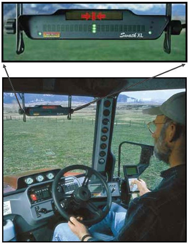 | 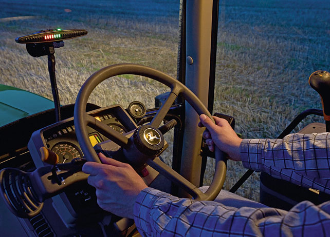 |
Figure 1: Lightbar operator’s view.[2] | Figure 2: Lightbar installed in tractor cabin.[3] |
Adding Guidance Assistance Systems to an existing farm not only allows the farmer to conduct field operations in a more timely manner reducing yield penalties but also allows him to expand farm size and remain timely with the existing equipment set.
Guided Navigation is easy to use. Anybody can learn to use GPS navigation systems, regardless of computer skills. The systems require only a little practice—typically about 30 minutes.
The necessary parts for the installation of a guidance system are:
- A GNSS receiver usually installed in the centre of the roof of the tractor’s cab
- A display that hosts the guidance computer and all navigation and setting menus
- The lightbar itself, which comes separately, embedded with the display or visually shown in the display
| John Deere Green Star Light bar: | Trimble EZ-Guide 250 Light bar Demo Video: |
During an experiment a planter was used 22.42 hours in the base during the May 17-23 time period, the period when planting operations were completed. When workday expansion and increased equipment time were installed, the planter was used only 17.99 hrs with 300 mm LB a difference of 4.43 hrs, which translates to 19% less labour and machine running time.[4]
Other tests in New Zealand and California showed that top speed could be increased by 13% and even more, and in other cases overlap and skip errors where reduced from 5 to 10% compared to manual driving with foam markers.[5]
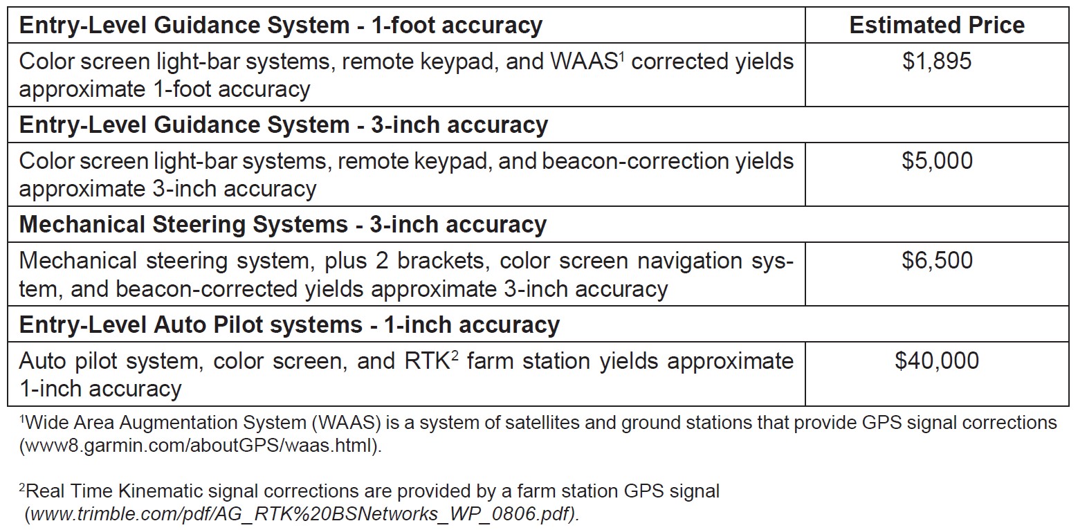


Benefits include:
- Reduction in overlap
- Increased speed of field operations
- Workday expansion
- Greater flexibility in hiring labour
- Appropriate placement of inputs.
WORKING PRINCIPLE
GNSS stands for Global Navigation Satellite System, and is the standard generic term for satellite navigation systems that provide autonomous geo-spatial positioning with global coverage and allow small electronic receivers to determine location (longitude, latitude, and altitude/elevation) using time signals transmitted along a line of sight by radio from satellites.
The advantage to having access to multiple satellites is accuracy, redundancy and availability at all times. Though satellite systems don’t often fail, if one fails GNSS receivers can pick up signals from other systems. Also if line of sight is obstructed, having access to multiple satellites is also a benefit. Common GNSS Systems are GPS, GLONASS, Galileo, Beidou and other regional systems.[8]
POSITIONING RECEIVER ACCURACY LEVELS
Sub-meter: Widely used in agriculture and other industries, single-frequency receivers with submeter level accuracy frequently rely on several alternative differential correction services provided by public and private entities. Popular in the past, the Coast Guard differential correction AM radio signal (known more commonly as Beacon) is broadcast through a network of towers located near navigable waters. More recently, Wide Area Augmentation System (WAAS) has been deployed by the Federal Aviation Administration to broadcast a satellite-based differential correction service. A similar service is available through free-of-charge John Deere StarFire 1 (SF1) and subscription-based OmniSTAR Virtual Base Station (VBS) options.
Decimeter: To achieve decimeter level accuracy, dual-frequency receivers can be used with subscription-based correction services, or with a local base DGPS station.
Centimeter: A local base station is also required to implement a Real Time Kinematic (RTK) differential correction service, which provides the ultimate centimeter level of accuracy. In certain locations around the US, local networks of permanent RTK base stations have been established by private entities to provide fee-based coverage of areas with relatively high demand for superior positioning accuracy.[9]
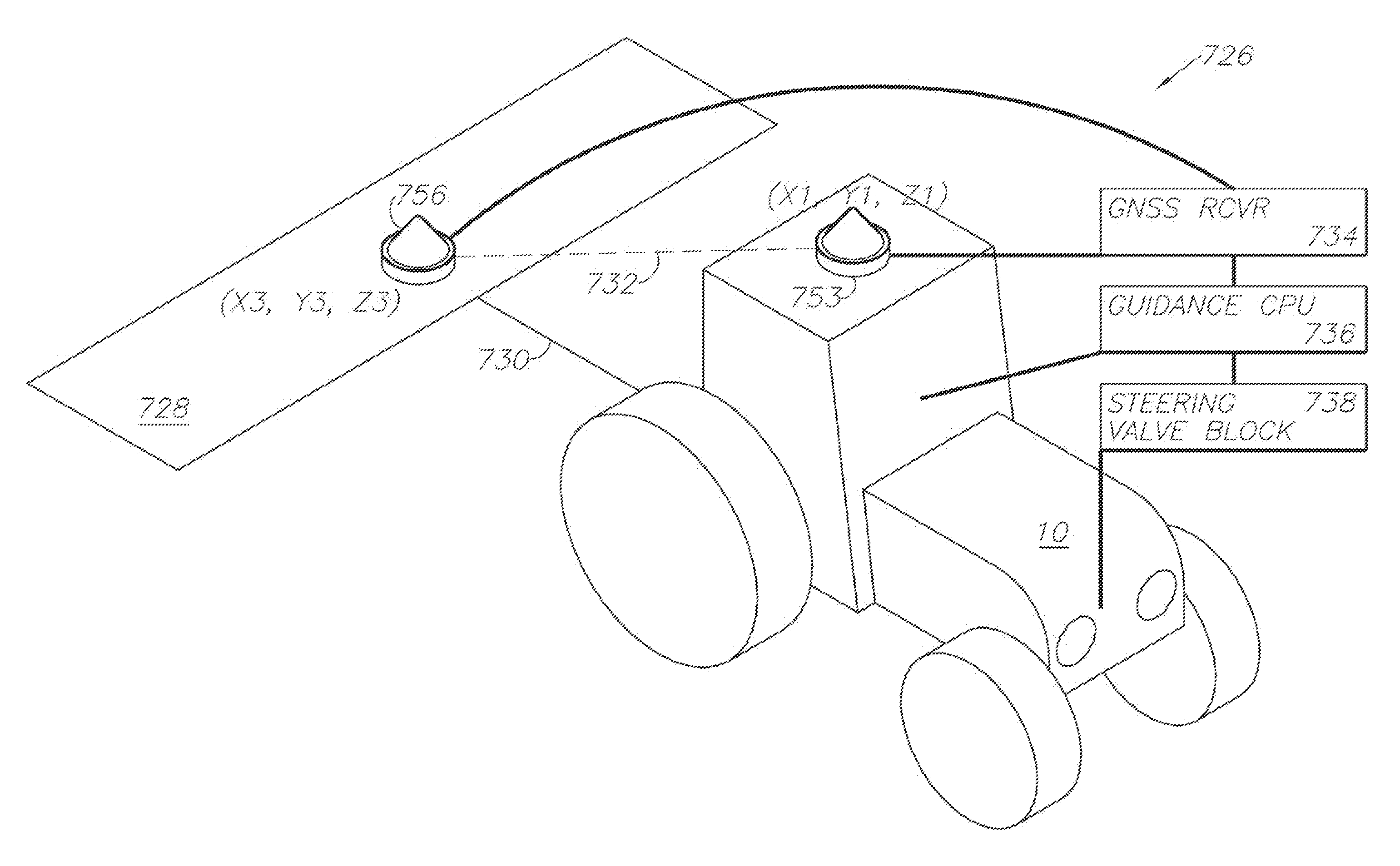 | 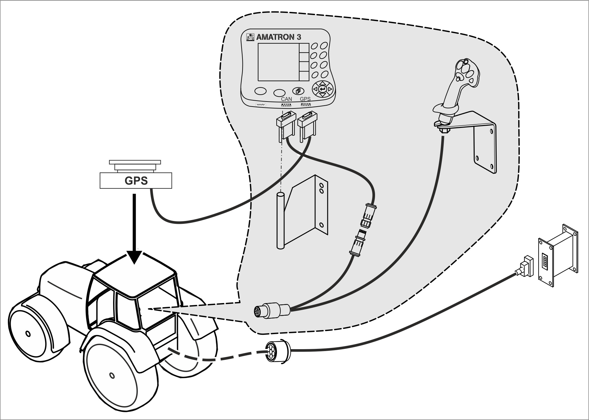 |
Figure 6. GNSS receiver position .[10] | Figure 7. Typical receiver and display wiring diagram.[11] |
Installation Guide videos for common Lightbar systems:
| GNSS Receiver: | Display: | Operation: |
References
[1] Hudson, Garris; Shofner, Robby; Wardlow, George; and Johnson, Donald (2007) “Evaluation of three tractor-guidance methods for parallel swathing at two field speeds,” Discovery, The Student Journal of Dale Bumpers College of Agricultural, Food and Life Sciences. University of Arkansas System Division of Agriculture. 8:61-66.
[2] Grisso, R. D., Alley, M. M., & Groover, G. E. (2005). Precision Farming Tools. GPS Navigation
[3] deere.co.uk
[4] Griffin, T., Lambert, D., & Lowenberg-DeBoer, J. (2005). Economics of lightbar and auto-guidance GPS navigation technologies. Precision agriculture, 5, 581-587
[5] Gan-Mor, S., & Clark, R. L. (1998). DGPS-based automatic guidance–implementation and economical analysis. In 2001 ASAE Annual Meeting (p. 1). American Society of Agricultural and Biological Engineers
[6] Groover, G. E., & Grisso, R. D. (2009). Investing in GPS guidance systems?.
[7] Adamchuk, V. I. (2008). EC08-706 Satellite Based Auto Guidance
[8] semiconductorstore.com/blog/2015/What-is-the-Difference-Between-GNSS-and-GPS/1550
[9] cropwatch.unl.edu/ssm/guidance
[10] patents.google.com/patent/US8594879
[11] amazone.net/3322.asp
Feature Image Source: trimble.com/agriculture/ez-guide-250.aspx?dtID=technical_support