
Drones with mounted Sensors [Student]
Introduction
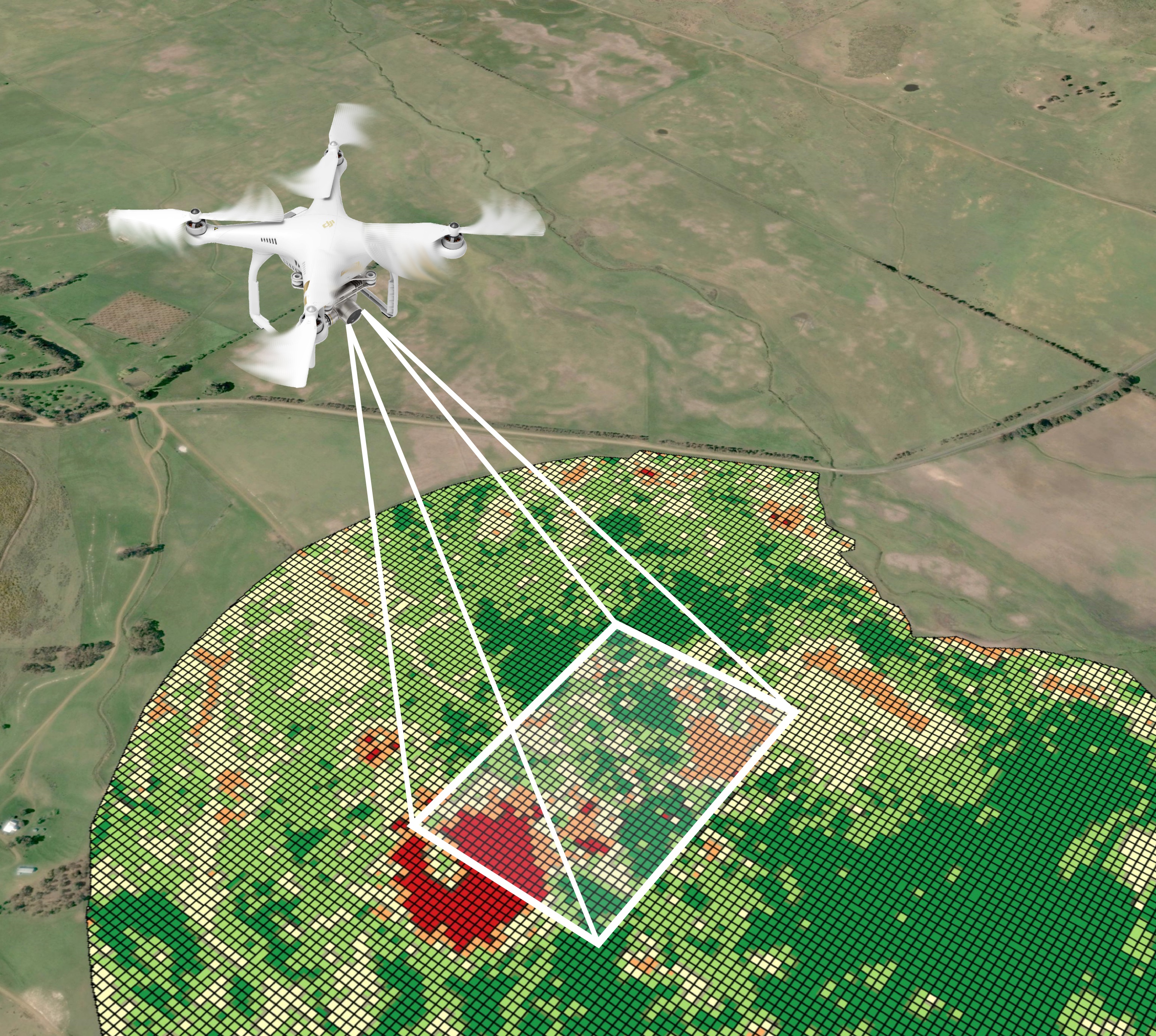
An unmanned aerial vehicle (UAV), commonly known as a “drone” is an aircraft without a human pilot aboard. The flight of UAVs may be controlled either autonomously by on-board computers or remote control pilot on the ground from distance. Agriculture is one of the main sectors that drones have find numerous uses and have been used for several agricultural applications. During the last years, drones have emerged as a key-factor in increasing productivity since they enable the generation of large amount of valuable data quickly and with minimal costs. Those data can then be translated to information, insights, estimations and observations on various aspects of the production such as crop and soil health, input management and disease outbreak or weed infestation control.
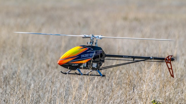
Single-Rotor: They are built to be strong and durable and do have a heavy payload capability and they are able to hover vertically in the air.
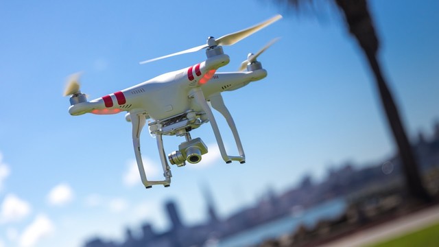
Multi-Rotor: They are easy to control and manoeuvre and also are really stable. They have the ability to hover.
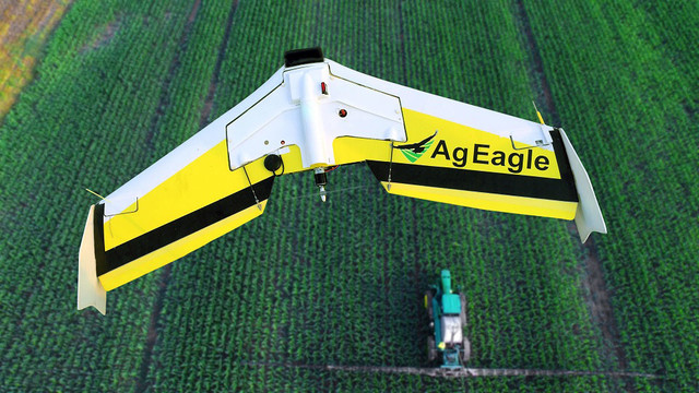
Fixed-Wing: It can fly at a high altitude and can carry more weight. It has an increased flight time.
UAV Sensors
When a drone is used for agricultural purposes, the most common applications involve the use of multispectral and thermal sensors.
Multispectral sensors are mostly used for their ability to capture near-infrared radiation (NIR) and ultraviolet light. In this way they provide farmers with valuable data that can lead to several observations on various crop parameters. One of the most common procedure is the generation of Normalized Difference Vegetation Index (NDVI) maps. This index leverages on the ability of healthy vegetation and photosynthetically active tissues to absorb solar radiation in the Red spectrum while reflects the largest part of the Near Infra-Red (NIR) spectrum. Therefore, this index indicates if a target being observed contains live green vegetation or not, and expresses it with values between 0 (no vegetation) and 1 (healthy and high vigor vegetation).
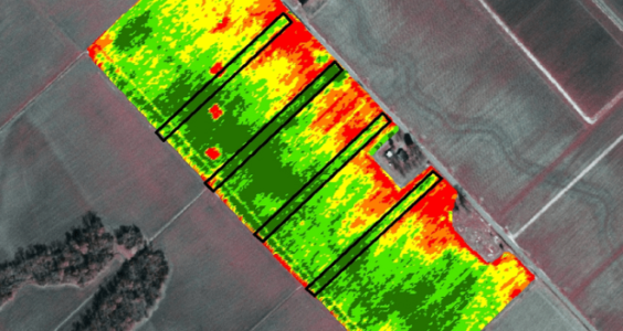 | 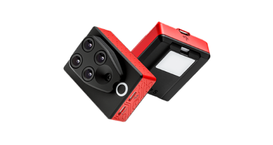 |
Figure 2: Example of an NDVI image.[6] | Figure 3: Multispectral sensor (Parrot Sequoia).[7] |
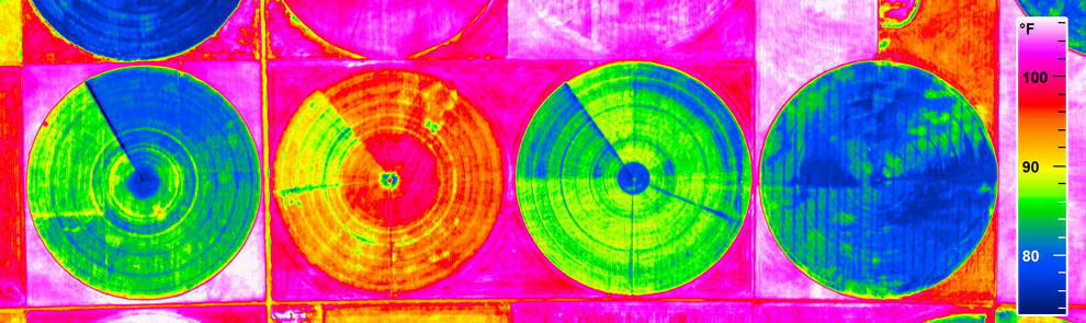
Thermal sensors measure the relative surface temperature of targets and create aerial thermal imaging for analysis and reporting.
This technology can be used to gain insight into:
- Heat stress
- Crop water use
- Plant metabolism
- Pinpoint the source of water leaks or waterlogging
Related Smart Farming Technology Products
Parrot Sequoia+
The Parrot Sequoia+ multispectral sensor is offering a comprehensive, adaptable solution that is compatible with all types of drones. With its two sensors, multispectral and sunshine, Parrot Sequoia+ analyses plants’ vitality by capturing the amount of light they absorb and reflect[3].
Quantix
Quantix quickly and accurately maps your acreage, allowing you to easily spot crop health and operational issues that might be missed by the naked eye.[4]
Gamaya
Gamaya is a “Drone-as-a-service” company which offers a hyperspectral imaging service using a camera that can be mounted on drones and is capable of mapping and distinguishing the weeds from plants. It is also able to identify other plant stresses such as disease and malnutrition, as well as chemical inputs in the soil.[5]
SenseFly
The eBee SQ agriculture drone captures actionable crop data across four multispectral bands, plus RGB imagery, spanning hundreds of acres in a single flight. SenseFly also offers the Ag 360 computer vision drone, which captures infrared images of fields to help farm owners monitor crops at different stages of growth and assess the condition of the soil.[6]
Related Scientific Articles
Monitoring of crop fields using multispectral and thermal imagery from UAV
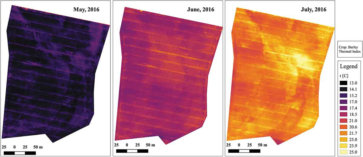
In this paper, the research team performed flights with a fixed-wing platform mounted with two different sensors – multispectral and thermal. Three vegetation indices were computed. Moreover, two thermal maps are presented to indicate the relation between vegetation and soil temperature.[7]
References
[1] Agribotix
[3] Parrot Sequoia+
[4] Quantix
[5] Gamaya
[6] SenseFly
[7] Monitoring of crop fields using multispectral and thermal imagery from UAV